Free shipping on all UK mainland orders - no minimum order price.
Couldn't load pickup availability
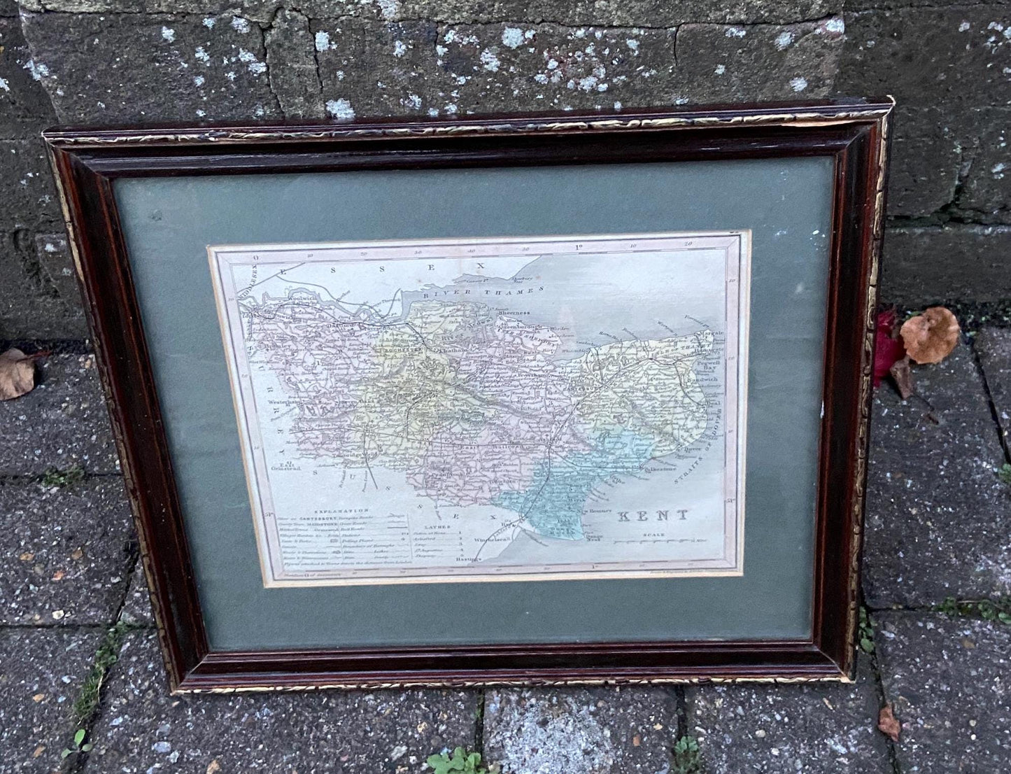
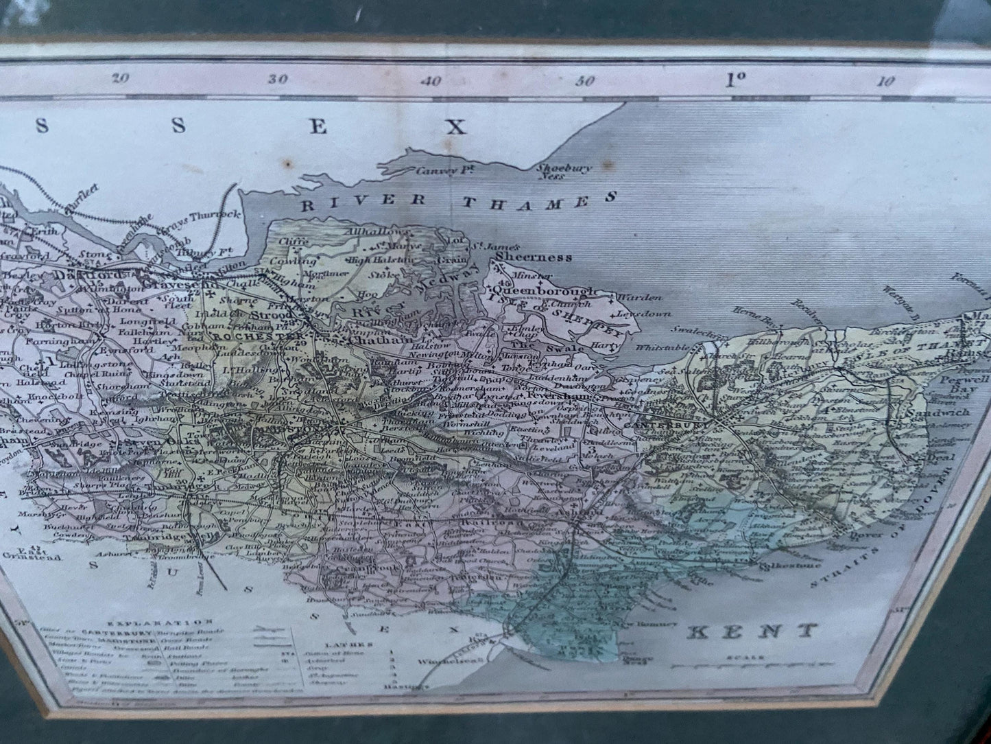
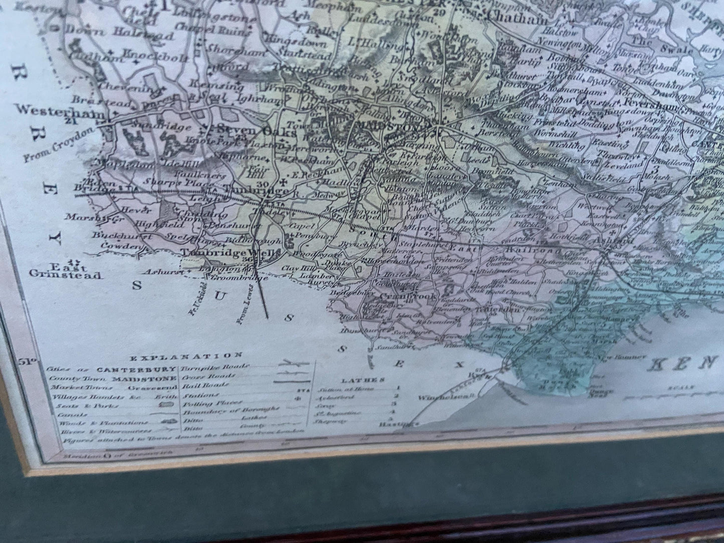
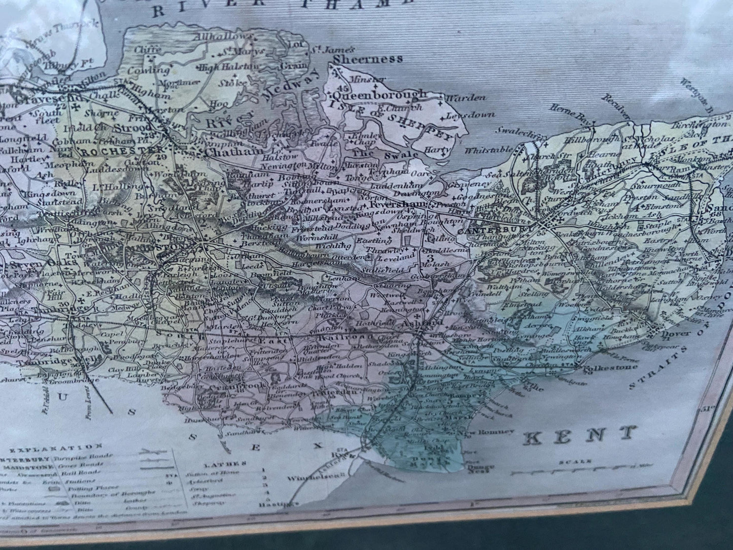
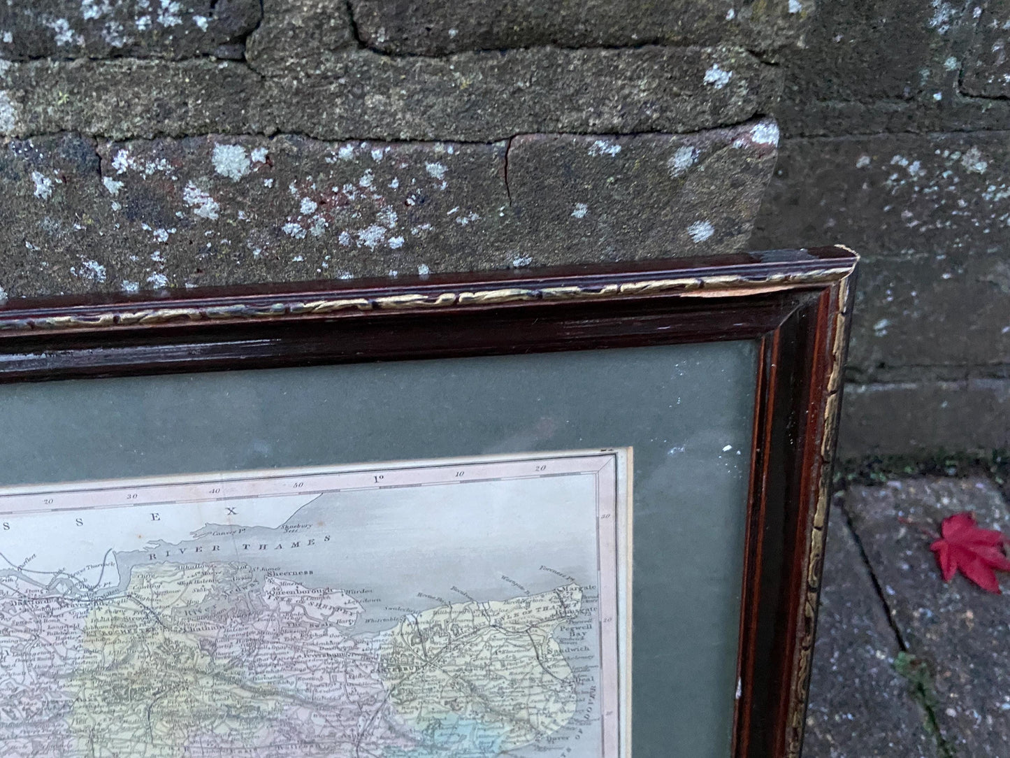
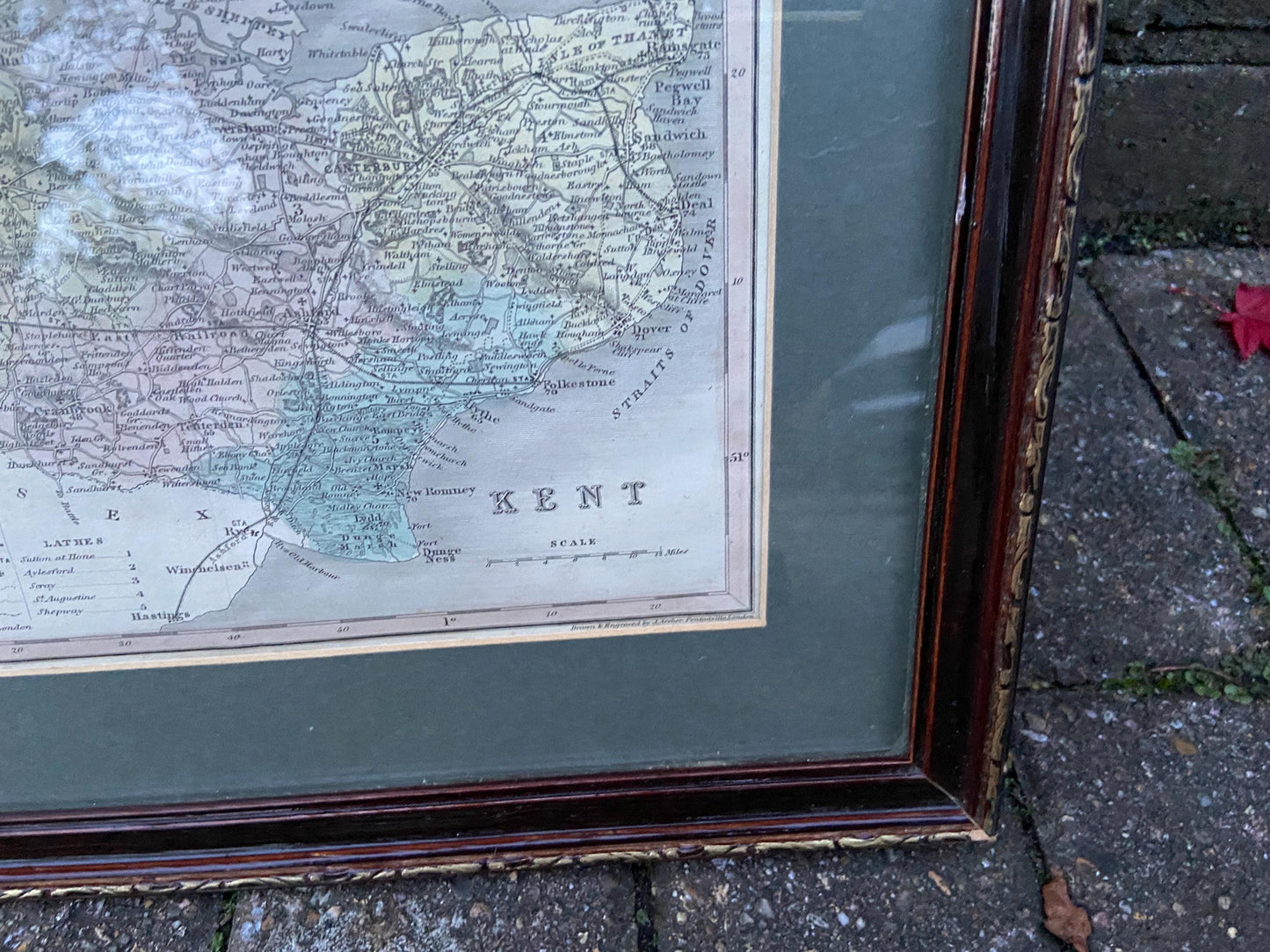
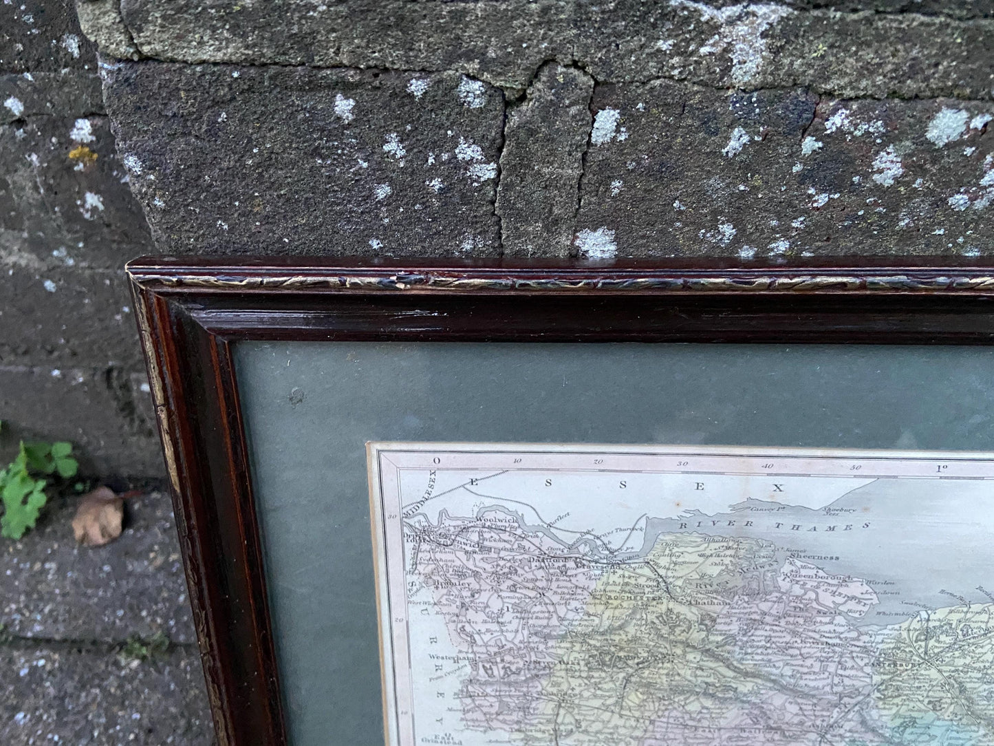
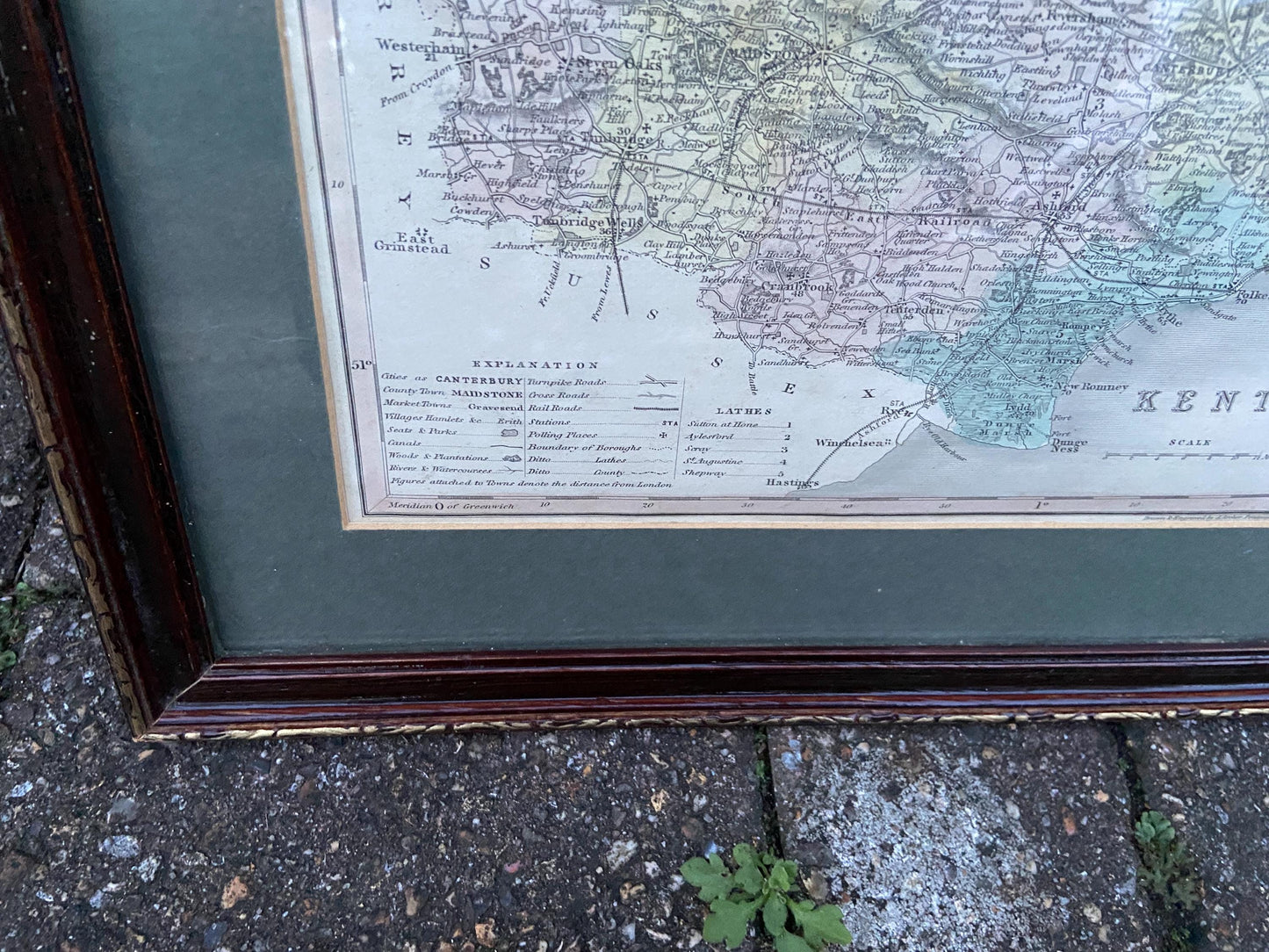
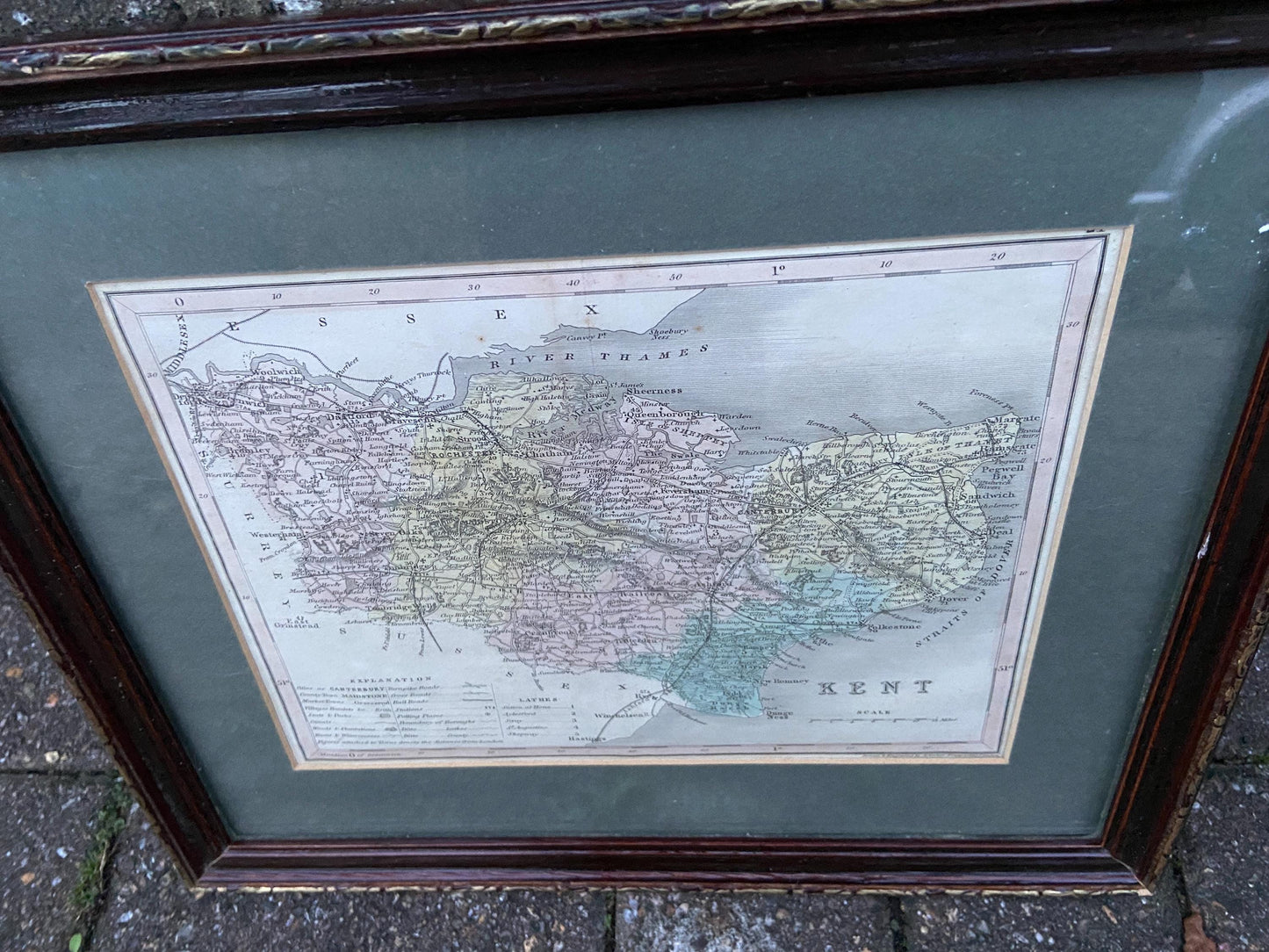
Joshua Archer (1792 – 1863) was well know as a British draughtsman and engraver. He meticulously drew maps of counties, highlighting their boundaries, settlements, roads, railway lines etc. These maps were published in various albums and books. Often these maps were printed in black and white and then hand painted. Which I think is the case with this one, although I can’t be sure. They are very informative and give you an excellent insight into our historic past.
This particular map is of Kent and covers the whole county up to the Thames estuary, down past Dungeness (before the power station of course!) and across to Surrey and Sussex, and the Straits of Dover. Days before the motorways and the Channel Tunnel. The map has an explanation on it in the bottom left, a Scale and the reference to L. Archer in the bottom right.
It is in good condition although evidence of a previous fold shows down the middle. There of course some signs of age on it, but it is still in great condition and is professionally framed in a lovely dark green card mount, and then in a lovely vintage wooden frame with a little bit of gilt detailing around the edge. The frame is mostly in vgc although the top right has a splinter of dark wood missing, a few other knocks, and some gilt has rubbed thin. The original back of the frame has been replaced at some point too. There is glazing which is intact, but no hook or string at present.
Please look at photos and video for more info.
Size: 35cm x 29.5cm frame; actual print 23.5cm x 18cm approx.